No products
Prices are tax excluded
Menu
- MEDICAL
- SCIENCE
- HIGH School Science
- MEDICAL Microscope Slides
- SCIENCE Microscope Slides
- CONFOCAL Training Slides
- CLEARANCE
- SLIDE Boxes & Mailers
- SPECIAL Slide Offers
- CONTACT US


Categories
- MEDICAL
- SCIENCE
- HIGH School Science
- MEDICAL Microscope Slides
- SCIENCE Microscope Slides
- CONFOCAL Training Slides
- CLEARANCE
- SLIDE Boxes & Mailers
- SPECIAL Slide Offers
- CONTACT US


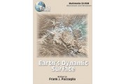
Earth's Dynamic Surface
New product
Earth's Dynamic Surface goes in-depth into the study of the processes that shape the Earth's surface.
By buying this product you can collect up to 24 loyalty points. Your cart will total 24 points that can be converted into a voucher of $3.60.
Volume discounts
| Quantity | Discount | You Save |
|---|---|---|
| 2 | 3% | Up to $6.52 |
| 3 | 5% | Up to $16.30 |


Earth's Dynamic Surface 1.1 is a useful tool for developing an understanding of the processes that shape Earth's surface. In this exciting CD-ROM, you are guided through each concept with full color animations, illustrations, and photographs while listening to the author's narration.
Review sections at the end of each chapter will reinforce the concepts covered. Interactive activities encourage participation and problem solving. In addition, the animated Physiographic Province Tour enables you to travel to destinations across the U.S. The tour stops at 42 national parks, monuments, and points of interest demonstrating examples of each process of change introduced in the program while offering web site links to each national park. Version 1.2 is compatible with Mac OS® X Yosemite (10.10).
Features:- Weathering and Soils-examines the two types of weathering processes and soil development throughout a landscape.
- Hillslopes-covers the interaction of rock-type and climate in the erosion of a landscape.
- Rivers-discusses flowing water as a process for erosion, transportation, and deposition of Earth's surface materials.
- Coastlines-examines the power of wind, waves, tides, and currents to shape unique landforms.
- Groundwater-covers the development of landforms due to flowing water below Earth's surface.
- Deserts and Winds-discusses changing landscapes due to the erosion, transportation, and deposition of surface material by wind.
- Glaciers and Climate-examines the process of flowing ice in the development of landforms.
- Physiographic Province Tour-takes students on a trip across the U.S. with stops at 42 National Parks and points of interest, including website links to each National Park appearing in the tour.
Interactive Activities:- Identify limits of a drainage basin
- Label rock types
- Study various weathering processes
- Identify soil age
- Explore reasons for hillslope failure
- Identify parts of a river system
- Calculate flow velocity
- Discover how sediment is transported
- Calculate currents
- Identify cave features
- Explore the effects of wind and water on a desert environment
- Identify types of sand dunes
- Discover the effects of seasons and climate on Earth
System Requirements: Macintosh: PowerPC™ G4, G5 or Intel® processor; RAM: 512 MBytes; Mac OS® X 10.4.11 or later (including QuickTime). Windows: Intel® Pentium® 4 or faster processor (or equivalent); RAM: 512 MBytes; Windows® XP Service Pack 2, Vista®, 7, or 8.1.